
Central Coast Council has developed online flood risk tools and updated flood and emergency planning information to help residents understand their own flood risk and be adequately prepared to respond.
Council Director Environment and Planning Alice Howe said the Central Coast had experienced various types of flooding and hat flooding would continue to be part of residents’ lives.
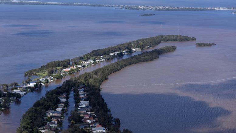
“While it’s not always possible to predict when, where, or how big the next flood will be, we can estimate the likelihood of different sizes of floods and their consequences by using computer flood modelling,” she said.
“Our new interactive online flood risk mapping tool for Tuggerah Lakes area draws on current flood levels directly from the Bureau of Meteorology and converts it into a visual display, which shows the extent of current, minor, moderate or major flood levels for specific properties in the area.
“For residents in other areas, the region-wide online mapping tool provides a range of flood information on a visual map.
“Both these flood risk tools help the community, especially residents living in low lying areas or within a floodplain, to visualise potential flood impacts to their properties and surrounding roads or access routes, and plan ahead to build resilience.”
She said Council had a holistic approach to disaster management which encompassed prevention, preparedness, response and recovery.
This approach is regularly reviewed and updated to incorporate new learnings from each disaster event, and shared knowledge from a range of key stakeholders including the community, lead emergency agencies and supporting organisations.
In addition to the flood risk tools, Council has also developed a suite of updated online information to help the community understand the types of flooding that occurs on the Central Coast, Council’s role in emergency management, water level data, and triggers for flood intervention.
The online information also includes simple steps to follow to plan and prepare for flooding, who to contact for help during a flood and how to stay informed.
Council Administrator Rik Hart said planning and preparing for flood emergencies is important and a shared responsibility.
“Council works hand in hand with lead emergency agencies (such as NSW State Emergency Service) and other organisations to share knowledge and resources to help our local communities prepare for floods and other natural disasters,” he said.
“Understanding flood risks and being prepared to respond is key for building community resilience.
“Council’s new flood risk tools, with localised information and resources, will help residents understand their risk, think about what they need to do and how they can help protect their home, belongings and family.
“I encourage our community to tap into these online resources, see how floods may affect them and be adequately prepared.”
To understand the types of flooding on the Central Coast, for online flood risk tools and for information to help plan and prepare for floods search ‘flooding’ at centralcoast.nsw.gov.au
Source:
Central Coast Council